
Matching Technology to Terrain — Across Solar, Wind, Hybrid, Hydro, PSP, BESS, and Nuclear
Beyond “is the land available”
In Chapter 1 we established that India has, in aggregate, sufficient land for its 500 GW ambition. The harder question is which land, for which technology. Each renewable subsector imposes a distinct matrix of meteorological, topographical, hydrological, geological, and infrastructural requirements. Mismatched siting is the single most expensive error a developer can make: a parcel with five percent slope rather than three is a project that will lose three to five percent of its yield, plus civil grading costs that compound across hundreds of acres. The suitability calculus is therefore not an academic exercise — it is the foundation of the levelised cost of electricity (LCOE) and, ultimately, of bankability.
Solar Photovoltaic: where insolation, slope, and substations converge
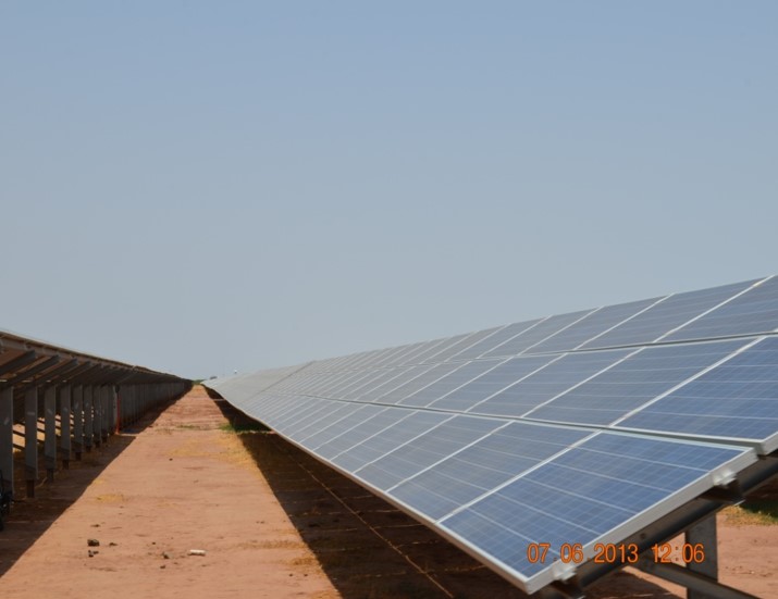
Utility-scale solar PV imposes three primary demands on land: high Global Horizontal Irradiance, gentle topography, and proximity to evacuation infrastructure. The Central Electricity Authority and MNRE historically benchmarked land use at four to five acres per megawatt, but advances in high-wattage modules and bifacial glass-glass packaging have allowed states like Rajasthan to revise their ceiling to four acres (1.62 hectares) per MW for crystalline silicon installations. GHI must generally exceed 1,000 kWh/m²/year, with the western desert belt of Rajasthan and Gujarat regularly recording above 2,000 kWh/m²/year. Slope is the silent killer: gradients above three percent induce inter-row self-shading, complicate single-axis tracker installation, and demand expensive earthworks. Single-axis trackers — now the default for utility-scale projects — add their own constraint, requiring near-flat plateaus to avoid asymmetric loading.
Grid proximity is the parameter most often underweighted in early-stage screening. Every additional kilometre between a project and the nearest 220 kV or 400 kV pooling substation adds capex, transmission losses, and Right-of-Way risk. The Central Electricity Authority’s 2024 review noted that fourteen interstate transmission projects were stalled due to RoW disputes, and the Gadag pooling station in Karnataka — designed to evacuate 1,500 MW of solar — saw RoW issues unresolved at twenty of twenty-nine tower locations despite compensation having been determined. The implication is unambiguous: developers should weight grid distance as heavily as irradiance in their multi-criteria scoring.
Onshore Wind: speed, terrain, and the case for repowering
Wind imposes a fundamentally different siting logic. The aerodynamic necessity of array spacing — typically five to seven rotor diameters between turbines — produces a much larger macro-footprint than solar, although the direct physical footprint of the turbine pads and access roads is minimal. The binding parameter is wind resource: a consistent mean wind speed exceeding six metres per second at hub height, validated through at least one full year of mast measurements. Unlike solar, wind benefits from undulating terrain — ridges, plateaus, and coastal cliffs accelerate flow — but slopes above thirty degrees become logistically prohibitive because modern 80-metre turbine blades and 200-tonne nacelles cannot be transported up steep gradients.
India’s prime wind corridors in Tamil Nadu, Gujarat, and Karnataka are now substantially saturated. The strategic frontier has shifted to repowering — replacing first-generation sub-megawatt turbines with modern 3 to 5 MW machines on the same land base. The MNRE’s repowering policy framework, refreshed in 2024, allows incumbent operators to extract three to five times the original capacity from existing wind farms without acquiring an additional acre. This is, in practice, the cheapest renewable land strategy in the country: it converts a sunk cost into an exponentially higher yield, sidesteps every consent-based obstacle, and reuses already-built evacuation infrastructure.
Hybrid projects: the geographic Venn diagram
Wind-solar hybrid projects exploit the spatial inefficiency of standalone wind farms, where vast tracts between turbines remain unutilised due to wake-effect spacing. Suitability requires a geographic overlap of high wind speeds and high solar irradiance — a Venn diagram concentrated in coastal Gujarat, southern Rajasthan, and parts of Karnataka and Tamil Nadu. The land must be flat enough to accommodate dense solar arrays while preserving aerodynamic spacing for the turbines. Co-location dramatically improves the utilisation factor of shared evacuation infrastructure: a single 400 kV substation that might serve a 250 MW standalone wind farm can comfortably evacuate 600-plus MW from a hybrid configuration, lowering the LCOE by 10 to 15 percent.
Hydropower, Small Hydro, and the rise of Pumped Storage
Hydropower siting is determined strictly by geomorphology and hydrology. Large hydro requires deep valleys for dam construction, sufficient catchment areas for reservoir formation, and rock strata capable of supporting hydrostatic loads without seismic vulnerability. Small Hydro Power (up to 25 MW) is generally run-of-river with minimal submergence, but demands continuous hydrological data and — in Himalayan regions — formal micro-landslide zonation maps to certify stability of penstocks and waterways. The newer and strategically critical category is Pumped Storage Hydropower (PSP), which the CEA originally projected at 26.7 GW by 2032 but has now revised to a 100 GW pathway over the next decade. As of August 2025, ten PSPs totalling 6,685 MW are operational, eleven projects (12,110 MW) are under construction, four (5,080 MW) are CEA-approved, and two (2,140 MW) are under examination.
PSP suitability is unforgiving. Closed-loop systems require two proximate but topographically distinct natural depressions with a significant gross head — typically 300 to 600 metres — capable of conversion into upper and lower reservoirs. Open-loop systems use an existing river or reservoir as the lower pond. Geologically, the intervening rock must be hard, non-porous, and free of seismic faults, since underground penstocks and powerhouse caverns must withstand decades of cyclic hydrostatic loading. In a major regulatory unlock, the Ministry of Power in August 2025 exempted off-stream closed-loop PSPs from CEA concurrence regardless of project cost, accelerating private development. The shape of India’s storage future is now visible: Maharashtra, Andhra Pradesh, and Odisha will host the largest installations, and Odisha’s 4,795 MW of high-quality potential makes it the single most strategically valuable state for grid balancing.
BESS and Nuclear: the bookends
Battery Energy Storage Systems are the spatial bookend at the small-footprint extreme. A 100 MWh lithium-ion installation typically occupies under two hectares, making BESS deployable inside existing solar parks (to capture clipped energy) or directly at urban load centres (for ancillary services and peak shaving). Suitability is governed less by climate than by safety: thermal runaway risks dictate strict spacing between battery containers, integrated HVAC, fire containment zones, elevation above floodplains, and proximity to the central grid for power conversion and battery management interconnection. Nuclear sits at the opposite extreme. The Atomic Energy Regulatory Board mandates a fully acquired Exclusion Zone of 1.5 km radius, a Sterilised Zone of 5 km where only natural population growth is permitted, and demographic norms requiring local population density below two-thirds of the state average and any 100,000-plus population centre at least 30 km away. Nuclear is therefore not a substitute for renewables on land economics; it is a complementary baseload technology with fundamentally different siting logic.
From atlas to anchor pin: how developers actually find land
The era of manual ground surveying ended a decade ago. Modern site selection follows a four-stage funnel. The first stage uses macro-resource atlases — the National Institute of Wind Energy (NIWE) Wind Atlas and the National Institute of Solar Energy (NISE) Solar Atlas — cross-referenced against the Central Transmission Utility network to find corridors where high resource overlaps with available evacuation. The second stage applies Geographic Information Systems and Multi-Criteria Decision Analysis, typically through the Analytic Hierarchy Process, to overlay slope, irradiance, ecological restrictions, and distance-to-grid into a composite suitability score. The third stage shifts to cadastral interrogation: through the Digital India Land Records Modernisation Programme (DILRMP) — now covering 95 percent of rural records — and the Bhunaksha platform, developers overlay digitised cadastral maps against their suitability layers to identify the precise ownership status, Patta or 7-12 extracts, and Field Measurement Books of every parcel of interest. The newer NAKSHA programme is extending equivalent digitisation to peri-urban and urban habitations.
The fourth stage is ground-truthing — the irreducible physical visit. Field teams verify undocumented encumbrances (informal encroachments, customary grazing routes, pending litigation not captured in digital records), assess micro-topography, confirm road access for heavy logistics, and conduct preliminary socio-economic engagement with host communities. Skipping this step is the single most reliable way to discover, six months and a hundred crores into development, that the parcel cannot in fact host the project. The next chapter turns from finding the land to acquiring it — and to the maze of state-by-state procedure, lease-versus-purchase economics, and structural obstacles that decide whether a project ever reaches financial closure.